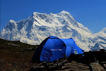
Pindari glacier trek is one of the easiest accessible glacial treks in Uttrakhand Himalaya located in upper Himalayan region of Bageshar district of Kumaun division. Pindari glacier trek is highly popular among high altitude trekking lovers and nature appreciators, for it offer magnificent land escape views of lofty snow clad mountains, companionship of rich flora and fauna, culture, tradition and life style of on rout villages which are still untouched by global modernization. The Pindari glacier is 3.5 km in length and 1.5 km in width, melting rapidly because of global warming and originates a beautiful river PINDAR meets with Alaknanda confluence tributary of the Ganga at Karnpriyag.
Pindari glacie is the only desstination which is accessible from Bageshwar district in Kumaun and Chamoli district in Garhwal divisions of Uttrakhand.
| HIGHEST ELEVATION POINT– | 3353mt. |
| TOTAL TREK LENGTH | 70km. |
| TOTAL TIME DURATION | 6 Nights & 7 Days. |
| TOTAL BEST TIME TO VISIT | May to June & Mid August to October |
| LOCATION | Pindari glacier is located at 3353 m to 3990 m just at the threshold of Nandadevi [highest mountain peak (7816 m) in Indian Himalaya] and Nandakote mountains of Bageshwar district of uttrakhand, India. |
Day 1:-KATHGODAM TO LOHARKHET
Kathgodam to Loharkhet via Almora (210 Kms, 10 HRS).
Day 2 :-TREK FROM LOHARKHET
Trek from Loharkhet to Dhakuri Top (10 KM, 5 HRS).


