16+
AGE
FOOD
FOOD
DIFFICULTY
DIFFICULTY
DURATION
DURATION
TEMPERATURE
PICKUP & DROP
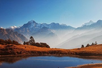
Panwali Kantha Is one of the most expansive alpine meadows in garhwalHimalayaslocated at 4000m hight. Simply click here in order to get addiitional information spin to win real money. It is known for its flat meadow land and huge variety of flowering herbs, wild life, scenic land escape views and vicinity to Gangotry greater Himalayan range.
| CLIMATE | Tem remains gentle in May & June harsh in Sep, October. |
| HIGHEST ELEVATION POINT– | 4000 m (Panwali Kantha ). |
| TOTAL TREK LENGTH | 39 kms ascending and ascending in kedarnath wild life sanctuary. |
| TOTAL TIME DURATION | 5 days 4 nights – from Rishikesh to Rishikesh. |
| BEST TIME TO VISIT | May June, Sep and October. |
| LOCATION | Panwali kantha meadow is situated in middle portion of Mandakini & Bhilangna rivers, in upper Himalayan zone of Tehri & Rudrapriag district of Uttrakhand,India. The trek start in Ghuttu village (Tehri) and ends at Triyugi Narayan( (Rudrapriyag) where solemn occation of Shive-Parvati marriage took place. |
1
Day 1
Rishikesh to Ghttu village (1525m ) = 34 kms drive passing Tehri lake.
2
Day 2
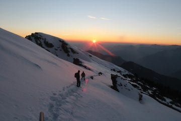
Ghuttu to Panwali Kantha (4000m ) = 18kms ascending trek .
3
Day 3
4
Day 4
5
Day 5